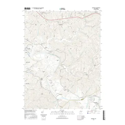
2016 Map of Kanawha
USGS Topo · Published 2016About this map
The Little Kanawha River meanders through this West Virginia landscape, anchoring a network of small valley settlements and rural ridges during the early 21st century. The map reveals a high density of family and community burial grounds, such as Ross-McCardle Cem and Leachtown Community Cem, which provide significant data points for genealogists tracking local lineages. The transition of former industrial infrastructure into recreational use is evident in the N Bend Rail Trail, which follows the river's path through towns like Davisville and Kanawha.
Find a feature on this map
76 named features on this map. Tap any name to fly to it.
Don’t see what you’re looking for? This feature index may not catch every label — zoom into the map to look around manually.
Map Details
Editions of this 2016 Kanawha Map
This is the sole edition of this map. No revisions or reprints were ever made.
Other maps of this area

1902 · Parkersburg
USGS Topo · 1:62,500

1904 · Parkersburg
USGS Topo · 1:62,500

1904 · Marietta
USGS Topo · 1:62,500

1906 · Elizabeth
USGS Topo · 1:62,500

1906 · Belleville
USGS Topo · 1:62,500

1924 · Belleville
USGS Topo · 1:62,500

1924 · Marietta
USGS Topo · 1:62,500

1924 · Elizabeth
USGS Topo · 1:62,500

1926 · Elizabeth
USGS Topo · 1:62,500

1926 · Belleville
USGS Topo · 1:62,500