
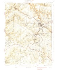
1939 Map of Kane
USGS Topo · Published 1939About this map
Kane serves as the primary hub of this northern Pennsylvania plateau landscape, where the confluence of several branches of Kinzua Creek and the Baltimore and Ohio railroad corridor defined the local economy before World War II. The map reveals a high density of small, industrial-era settlements and mail stops, such as Russell City De Young P O and James City, many of which were centers for timbering or glass manufacturing.
Find a feature on this map
89 named features on this map. Tap any name to fly to it.
Don’t see what you’re looking for? This feature index may not catch every label — zoom into the map to look around manually.
Map Details
Editions of this 1939 Kane Map
3 editions found
Other maps of this area

1906 · Warren
USGS Topo · 1:62,500

1907 · Warren
USGS Topo · 1:62,500

1908 · Warren
USGS Topo · 1:62,500

1918 · Loleta
USGS Topo · 1:62,500

1924 · Bradford
USGS Topo · 1:62,500

1926 · Bradford
USGS Topo · 1:62,500

1934 · Kane
USGS Topo · 1:48,000

1935 · Sheffield
USGS Topo · 1:48,000

1935 · Mt. Jewett
USGS Topo · 1:48,000

1936 · Kinzua
USGS Topo · 1:48,000
Featured Places
- Kane, PA
- Sheffield Township, PA
- Wetmore, Hamilton Township
- Sergeant, Wetmore Township
- Lamont, Jones Township