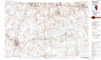
1991 Map of Kankakee
USGS Topo · Published 1991About this map
The Kankakee River and its intricate drainage network, including the Iroquois River and Singleton Ditch, anchor this 1991 survey of the Illinois and Indiana borderlands. The landscape is a study in transition from the established urban centers of Kankakee, Bourbonnais, and Bradley to the extensive managed marshlands and wildlife areas to the east. Extensive conservation lands like the Willow Slough State Fish and Wildlife Area and Beaver Lake Wildlife Refuge reveal the scale of regional water management and land preservation efforts.
Find a feature on this map
347 named features on this map. Tap any name to fly to it.
Don’t see what you’re looking for? This feature index may not catch every label — zoom into the map to look around manually.
Map Details
Editions of this 1991 Kankakee Map
This is the sole edition of this map. No revisions or reprints were ever made.
Other maps of this area

1890 · Des Plaines
USGS Topo · 1:62,500

1892 · Joliet
USGS Topo · 1:62,500

1892 · Calumet
USGS Topo · 1:62,500

1892 · Wilmington
USGS Topo · 1:62,500

1893 · Calumet
USGS Topo · 1:62,500

1894 · Des Plaines
USGS Topo · 1:62,500

1900 · Des Plaines
USGS Topo · 1:62,500

1900 · Toleston
USGS Topo · 1:62,500

1900 · Calumet
USGS Topo · 1:62,500

1901 · Calumet
USGS Topo · 1:62,500