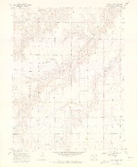
1969 Map of Kanorado NW
USGS Topo · Published 1972About this map
Bonny Creek and Little Beaver Creek define the drainage patterns across this High Plains landscape in Kit Carson County. During the late 1960s, the terrain was characterized by a systematic network of well sites, reflecting the critical importance of water access for agriculture and livestock in this arid portion of eastern Colorado. The topography is marked by subtle draws and the shifting course of seasonal waterways, which carve low-relief valleys through the prairie. Land use is predominantly rural and agricultural, with numerous surveyed section lines and access roads connecting isolated ranching operations. The spatial distribution of Well sites across the township lines of R. 43 W. and R. 42 W. provides a clear view of how the natural geography influenced the local economy and settlement density just before the early 1970s.
Find a feature on this map
4 named features on this map. Tap any name to fly to it.
Don’t see what you’re looking for? This feature index may not catch every label — zoom into the map to look around manually.
Map Details
Editions of this 1969 Kanorado NW Map
2 editions found
Other maps of this area

1950 · Bonny Reservoir
USGS Topo · 1:62,500

1954 · Limon
USGS Topo · 1:250,000

1957 · Limon
USGS Topo · 1:250,000

1958 · Limon
USGS Topo · 1:250,000

1969 · Kanorado NE
USGS Topo · 1:24,000

1969 · Burlington
USGS Topo · 1:24,000

1969 · Idalia SE
USGS Topo · 1:24,000

1969 · Peconic
USGS Topo · 1:24,000

1969 · Kanorado NW
USGS Topo · 1:24,000
1969 · Burlington NE
USGS Topo · 1:24,000