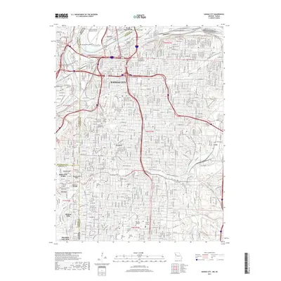
2017 Map of Kansas City
USGS Topo · Published 2017About this map
French Bottom and the Kansas River Bend highlight the industrial and riverine roots of the city, where the Missouri River meets the Kansas River. This 2017 survey details the complex urban grid stretching from North Kansas City south through Kansas City to Prairie Village. The map documents a high concentration of institutional landmarks, including the University of Missouri-Kansas City and Rockhurst University, alongside established residential enclaves like Mission Hills and Fairway. Genealogists will find significant value in the clear demarcation of historic burial grounds such as Elmwood Cemetery, Union Cemetery, and the Shawnee Methodist Mission Cemetery. The industrial corridor is anchored by the Kansas City Southern Railway and the settlement of Leeds, while the northern reaches are dominated by the Charles B Wheeler Downtown Airport.
Find a feature on this map
189 named features on this map. Tap any name to fly to it.
Don’t see what you’re looking for? This feature index may not catch every label — zoom into the map to look around manually.
Map Details
Editions of this 2017 Kansas City Map
This is the sole edition of this map. No revisions or reprints were ever made.
Other maps of this area

1887 · Harrisonville
USGS Topo · 1:125,000

1887 · Olathe
USGS Topo · 1:125,000

1890 · Kansas City
USGS Topo · 1:125,000

1892 · Harrisonville
USGS Topo · 1:125,000

1893 · Olathe
USGS Topo · 1:125,000

1894 · Kansas City
USGS Topo · 1:125,000

1894 · Harrisonville
USGS Topo · 1:125,000

1894 · Independence
USGS Topo · 1:125,000

1934 · Independence
USGS Topo · 1:24,000

1934 · Grandview
USGS Topo · 1:24,000