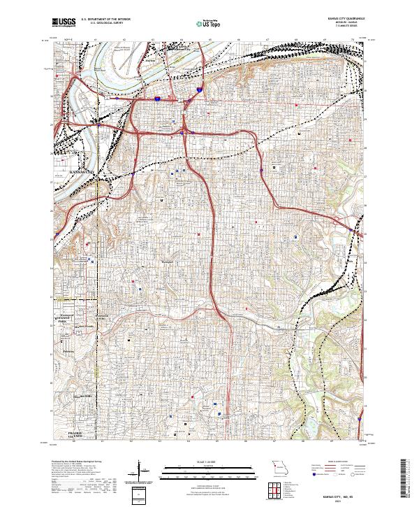
2021 Map of Kansas City
USGS Topo · Published 2021About this map
Kansas City and its surrounding communities are defined by the convergence of the Missouri River and Kansas River, creating a complex landscape of industrial bottoms and residential ridges. The sprawling rail infrastructure of the Kansas City Southern Ry and numerous river crossings, including the Broadway Bridge and Paseo Bridge, illustrate the city's role as a major transportation hub. From the historic French Bottom to the residential character of Westport and Mission Hills, the map shows the contrast between the river-level industry and the southern parklands. The concentration of civic and educational institutions, such as the Jackson County Courthouse and the University of Missouri-Kansas City, anchors the urban core. Significant green spaces like Swope Park and Loose Memorial Park provide a counterpoint to the dense street grids and highway networks that connect the Missouri and Kansas sides of the state line.
Find a feature on this map
57 named features on this map. Tap any name to fly to it.
Don’t see what you’re looking for? This feature index may not catch every label — zoom into the map to look around manually.
Map Details
Editions of this 2021 Kansas City Map
This is the sole edition of this map. No revisions or reprints were ever made.
Other maps of this area

1887 · Harrisonville
USGS Topo · 1:125,000

1887 · Olathe
USGS Topo · 1:125,000

1890 · Kansas City
USGS Topo · 1:125,000

1892 · Harrisonville
USGS Topo · 1:125,000

1893 · Olathe
USGS Topo · 1:125,000

1894 · Kansas City
USGS Topo · 1:125,000

1894 · Harrisonville
USGS Topo · 1:125,000

1894 · Independence
USGS Topo · 1:125,000

1934 · Independence
USGS Topo · 1:24,000

1934 · Grandview
USGS Topo · 1:24,000