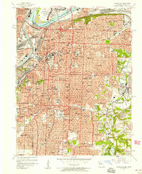
1957 Map of Kansas City
USGS Topo · Published 1958About this map
Kansas City spans the junction of the Missouri River and Kansas River in this mid-century topographic record, showing a dense urban landscape defined by major public works and industrial hubs. Central to the map is the massive Union Station complex and the towering Liberty Memorial, overlooking a city transitioning into the interstate era. The survey captures the metropolitan core before modern highway loops fully reshaped the neighborhoods, highlighting established community landmarks like the Art Institute and Nelson Art Gallery.
Find a feature on this map
152 named features on this map. Tap any name to fly to it.
Don’t see what you’re looking for? This feature index may not catch every label — zoom into the map to look around manually.
Map Details
Editions of this 1957 Kansas City Map
This is the sole edition of this map. No revisions or reprints were ever made.
Other maps of this area

1887 · Harrisonville
USGS Topo · 1:125,000

1887 · Olathe
USGS Topo · 1:125,000

1890 · Kansas City
USGS Topo · 1:125,000

1892 · Harrisonville
USGS Topo · 1:125,000

1893 · Olathe
USGS Topo · 1:125,000

1894 · Kansas City
USGS Topo · 1:125,000

1894 · Harrisonville
USGS Topo · 1:125,000

1894 · Independence
USGS Topo · 1:125,000

1934 · Independence
USGS Topo · 1:24,000

1934 · Grandview
USGS Topo · 1:24,000