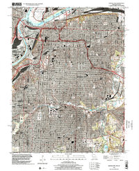
1996 Map of Kansas City
USGS Topo · Published 2002About this map
Kansas City anchors this topographic study at the confluence of the Missouri River and Kansas River, revealing a landscape defined by industrial development and an expansive system of parks. The city's growth is marked by major infrastructure like the Lewis and Clark Viaduct and the Paseo Bridge, while the historical core remains visible through its numerous civic squares and burial grounds. Beyond the urban grid, the map traces the suburban character of Roeland Park and Mission Hills, where the winding paths of Brush Creek provide a natural contrast to the dense municipal layout. From the Downtown Airport in the north to the sprawling reaches of Swope Park, the sheet documents the mid-century evolution of the Kansas-Missouri border, including the industrial activity at the Blue River and several active quarries.
Find a feature on this map
45 named features on this map. Tap any name to fly to it.
Don’t see what you’re looking for? This feature index may not catch every label — zoom into the map to look around manually.
Map Details
Editions of this 1996 Kansas City Map
This is the sole edition of this map. No revisions or reprints were ever made.
Other maps of this area

1887 · Harrisonville
USGS Topo · 1:125,000

1887 · Olathe
USGS Topo · 1:125,000

1890 · Kansas City
USGS Topo · 1:125,000

1892 · Harrisonville
USGS Topo · 1:125,000

1893 · Olathe
USGS Topo · 1:125,000

1894 · Kansas City
USGS Topo · 1:125,000

1894 · Harrisonville
USGS Topo · 1:125,000

1894 · Independence
USGS Topo · 1:125,000

1934 · Independence
USGS Topo · 1:24,000

1934 · Grandview
USGS Topo · 1:24,000