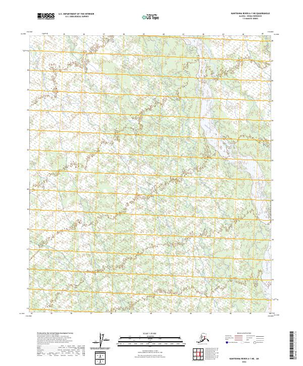
2024 Map of Kantishna River A-1 NE
USGS Topo · Published 2024About this map
The Toklat River winds through this interior Alaskan landscape, defining the eastern portion of the terrain as it flows northward toward the Tanana valley. This 2024 map documents a wilderness dominated by vast wetland complexes and braided river systems characteristic of the Denali region. To the west, the meandering course of Clear Creek threads through the low-lying interior, illustrating the dynamic hydrology of the subarctic plains. The map's grid, marked by sections of t8s r13w and t9s r14w, reveals a landscape largely devoid of permanent human settlement or modern infrastructure, emphasizing the preservation of the natural drainage patterns and the untouched character of the northern bush.
Find a feature on this map
7 named features on this map. Tap any name to fly to it.
Don’t see what you’re looking for? This feature index may not catch every label — zoom into the map to look around manually.
Map Details
Editions of this 2024 Kantishna River A-1 NE Map
This is the sole edition of this map. No revisions or reprints were ever made.
Other maps of this area

1948 · Kantishna River
USGS Topo · 1:250,000

1950 · Fairbanks
USGS Topo · 1:250,000

1951 · Kantishna River
USGS Topo · 1:250,000

1951 · Fairbanks
USGS Topo · 1:250,000

1952 · Fairbanks A-6
USGS Topo · 1:63,360

1952 · Kantishna River A-1
USGS Topo · 1:63,360

1952 · Kantishna River
USGS Topo · 1:250,000

1952 · Kantishna River B-1
USGS Topo · 1:63,360

1952 · Fairbanks
USGS Topo · 1:250,000
1953 · Fairbanks B-6
USGS Topo · 1:63,360