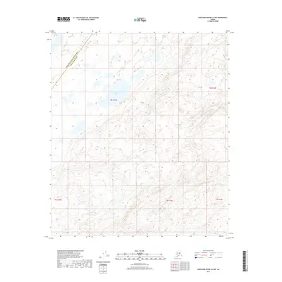
2017 Map of Kantishna River A-2 NW
USGS Topo · Published 2017About this map
The boundary between the Yukon-Koyukuk Census Area and the Denali Borough bisects this interior Alaskan landscape, marking a jurisdictional divide through an area defined by its complex hydrology. The northern half of the quadrangle is characterized by a high density of small ponds and thaw lakes, with Mucha Lake serving as the most prominent named water body. To the east, the drainage of Lynx Cr winds through the terrain, illustrating the intricate network of tributaries that feed the larger regional watersheds. This 2017 survey provides a precise record of the public land survey system grid, showing the townships and ranges of t8s r17w, t8s r16w, t9s r18w, t9s r17w, and t9s r16w. The lack of road infrastructure or named settlements emphasizes the wilderness character of this region during the early twenty-first century.
Find a feature on this map
8 named features on this map. Tap any name to fly to it.
Don’t see what you’re looking for? This feature index may not catch every label — zoom into the map to look around manually.
Map Details
Editions of this 2017 Kantishna River A-2 NW Map
This is the sole edition of this map. No revisions or reprints were ever made.
Other maps of this area

1948 · Kantishna River
USGS Topo · 1:250,000

1951 · Kantishna River
USGS Topo · 1:250,000

1952 · Kantishna River A-3
USGS Topo · 1:63,360

1952 · Kantishna River
USGS Topo · 1:250,000

1952 · Kantishna River A-2
USGS Topo · 1:63,360

1953 · Kantishna River B-2
USGS Topo · 1:63,360

1953 · Kantishna River B-3
USGS Topo · 1:63,360

1953 · Kantishna River A-3
USGS Topo · 1:63,360

1964 · Kantishna River
USGS Topo · 1:250,000
2017 · Kantishna River B-3 SE
USGS Topo · 1:25,000