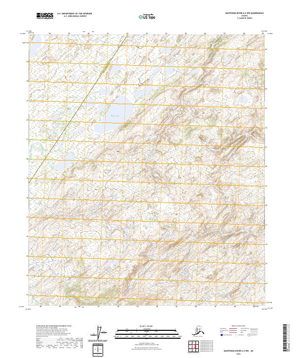
2024 Map of Kantishna River A-2 NW
USGS Topo · Published 2024About this map
Mucha Lake sits at the center of this interior Alaska landscape, positioned near the jurisdictional boundary where the Denali Borough meets the Yukon-Koyukuk Census Area. This topographic survey captures the intricate drainage patterns of the region, specifically along the winding course of Lynx Creek as it moves through the northern sections. The map is defined by its Public Land Survey System grid, clearly demarcating townships such as t8s r17w and t9s r17w. The terrain is characterized by a high density of small wetlands and depressions typical of the Alaskan subarctic, providing a clear record of the hydrography before any significant modern development or alteration. It serves as a detailed spatial reference for the remote interior, showing the natural relationship between the larger standing water of Mucha Lake and the surrounding fluvial systems.
Find a feature on this map
8 named features on this map. Tap any name to fly to it.
Don’t see what you’re looking for? This feature index may not catch every label — zoom into the map to look around manually.
Map Details
Editions of this 2024 Kantishna River A-2 NW Map
This is the sole edition of this map. No revisions or reprints were ever made.
Other maps of this area

1948 · Kantishna River
USGS Topo · 1:250,000

1951 · Kantishna River
USGS Topo · 1:250,000

1952 · Kantishna River A-3
USGS Topo · 1:63,360

1952 · Kantishna River
USGS Topo · 1:250,000

1952 · Kantishna River A-2
USGS Topo · 1:63,360

1953 · Kantishna River B-2
USGS Topo · 1:63,360

1953 · Kantishna River B-3
USGS Topo · 1:63,360

1953 · Kantishna River A-3
USGS Topo · 1:63,360

1964 · Kantishna River
USGS Topo · 1:250,000
2017 · Kantishna River B-3 SE
USGS Topo · 1:25,000