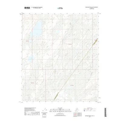
2017 Map of Kantishna River A-3 NE
USGS Topo · Published 2017About this map
Square Lake and the meandering drainage of John Hansen Cr dominate this interior landscape, reflecting the intricate hydrography of the Alaskan wilderness. This 2017 study details a region defined by extensive wetlands and seasonal water patterns rather than human infrastructure. The boundary line dividing the Yukon-Koyukuk Census Area and the Denali Borough cuts diagonally across the southeastern portion of the map, marking a transition between these two vast administrative districts. In an area where traditional settlements are absent, the mapping of township and range lines like t8s r19w and t9s r18w provides the primary framework for land navigation and property identification.
Find a feature on this map
7 named features on this map. Tap any name to fly to it.
Don’t see what you’re looking for? This feature index may not catch every label — zoom into the map to look around manually.
Map Details
Editions of this 2017 Kantishna River A-3 NE Map
This is the sole edition of this map. No revisions or reprints were ever made.
Other maps of this area

1948 · Kantishna River
USGS Topo · 1:250,000

1951 · Kantishna River
USGS Topo · 1:250,000

1952 · Kantishna River A-3
USGS Topo · 1:63,360

1952 · Kantishna River
USGS Topo · 1:250,000

1952 · Kantishna River A-2
USGS Topo · 1:63,360

1953 · Kantishna River B-2
USGS Topo · 1:63,360

1953 · Kantishna River B-3
USGS Topo · 1:63,360

1953 · Kantishna River A-3
USGS Topo · 1:63,360

1964 · Kantishna River
USGS Topo · 1:250,000
2017 · Kantishna River B-3 SE
USGS Topo · 1:25,000