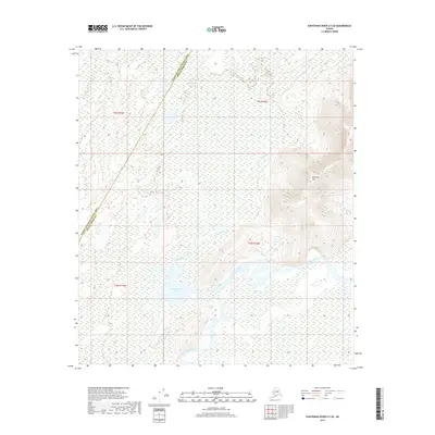
2017 Map of Kantishna River A-3 SE
USGS Topo · Published 2017About this map
The Kantishna River meanders through a landscape defined by extensive wetlands and complex water systems in this interior Alaskan wilderness. The terrain is largely dominated by the river's floodplain, punctuated by the presence of John Hansen Lake and the various branches of John Hansen Creek. Rising above the surrounding lowlands, Bearpaw Mtn serves as the primary topographic landmark on the eastern side of the survey area. This 2017 edition by the U.S. Geological Survey also documents the administrative boundary between the Yukon-Koyukuk Census Area and the Denali Borough, which cuts diagonally across the northern and western sections of the map. The intricate network of small streams and marshy ground highlights the natural drainage patterns of this subarctic environment prior to any modern industrial development.
Find a feature on this map
10 named features on this map. Tap any name to fly to it.
Don’t see what you’re looking for? This feature index may not catch every label — zoom into the map to look around manually.
Map Details
Editions of this 2017 Kantishna River A-3 SE Map
This is the sole edition of this map. No revisions or reprints were ever made.
Other maps of this area

1948 · Kantishna River
USGS Topo · 1:250,000

1951 · Kantishna River
USGS Topo · 1:250,000

1952 · Mount McKinley
USGS Topo · 1:250,000

1952 · Kantishna River A-3
USGS Topo · 1:63,360

1952 · Kantishna River
USGS Topo · 1:250,000

1952 · Kantishna River A-2
USGS Topo · 1:63,360

1952 · Mount McKinley D-3
USGS Topo · 1:63,360

1953 · Kantishna River A-3
USGS Topo · 1:63,360

1954 · Mount McKinley D-2
USGS Topo · 1:63,360

1958 · Mount McKinley
USGS Topo · 1:250,000