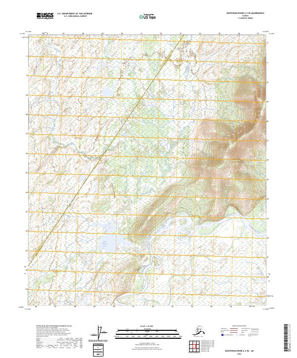
2024 Map of Kantishna River A-3 SE
USGS Topo · Published 2024About this map
Kantishna River meanders through the heart of this interior Alaskan landscape, defining the transition between the Denali Borough and Yukon-Koyukuk Census Area. The hydrology is the primary feature of the terrain, with John Hansen Creek feeding into the substantial John Hansen Lake before joining the larger river system. This area, largely defined by its wetland patterns and drainage basins, is punctuated by the significant elevation of Bearpaw Mtn in the east. The land is organized by the Public Land Survey System, showing segments of Townships 9 and 10 South across Ranges 18 and 19 West. The map provides a detailed view of the natural watercourses and topographic shifts where the high ground of the mountain meets the vast drainage plains of the river valley.
Find a feature on this map
9 named features on this map. Tap any name to fly to it.
Don’t see what you’re looking for? This feature index may not catch every label — zoom into the map to look around manually.
Map Details
Editions of this 2024 Kantishna River A-3 SE Map
This is the sole edition of this map. No revisions or reprints were ever made.
Other maps of this area

1948 · Kantishna River
USGS Topo · 1:250,000

1951 · Kantishna River
USGS Topo · 1:250,000

1952 · Mount McKinley
USGS Topo · 1:250,000

1952 · Kantishna River A-3
USGS Topo · 1:63,360

1952 · Kantishna River
USGS Topo · 1:250,000

1952 · Kantishna River A-2
USGS Topo · 1:63,360

1952 · Mount McKinley D-3
USGS Topo · 1:63,360

1953 · Kantishna River A-3
USGS Topo · 1:63,360

1954 · Mount McKinley D-2
USGS Topo · 1:63,360

1958 · Mount McKinley
USGS Topo · 1:250,000