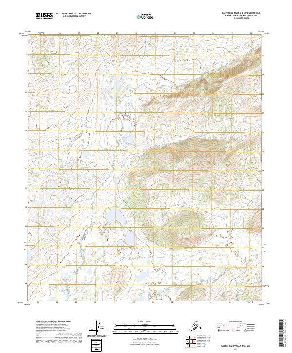
2024 Map of Kantishna River A-5 SW
USGS Topo · Published 2024About this map
Untamed Alaskan interior dominates this 2024 survey of the T9s R25w and T9s R24w township sections. The terrain is defined by a dense concentration of wetlands and unnamed water bodies scattered throughout the lowland basins. Elevation shifts are documented through detailed contouring of isolated hills and ridges that rise between the T10s R25w and T10s R24w boundaries. This modern topographic record, produced by the U.S. Geological Survey, focuses on the natural hydrology and landform characteristics of the Yukon-Koyukuk Census Area. The lack of named human settlements or infrastructure emphasizes the remote, undeveloped character of the landscape in the early 21st century.
Find a feature on this map
4 named features on this map. Tap any name to fly to it.
Don’t see what you’re looking for? This feature index may not catch every label — zoom into the map to look around manually.
Map Details
Editions of this 2024 Kantishna River A-5 SW Map
This is the sole edition of this map. No revisions or reprints were ever made.
Other maps of this area

1948 · Kantishna River
USGS Topo · 1:250,000

1951 · Kantishna River
USGS Topo · 1:250,000

1952 · Mount McKinley
USGS Topo · 1:250,000

1952 · Kantishna River
USGS Topo · 1:250,000

1952 · Kantishna River A-5
USGS Topo · 1:63,360

1952 · Kantishna River A-6
USGS Topo · 1:63,360

1953 · Mount McKinley D-5
USGS Topo · 1:63,360
1953 · Kantishna River A-6
USGS Topo · 1:63,360

1954 · Mount McKinley D-5
USGS Topo · 1:63,360

1958 · Mount McKinley D-6
USGS Topo · 1:63,360