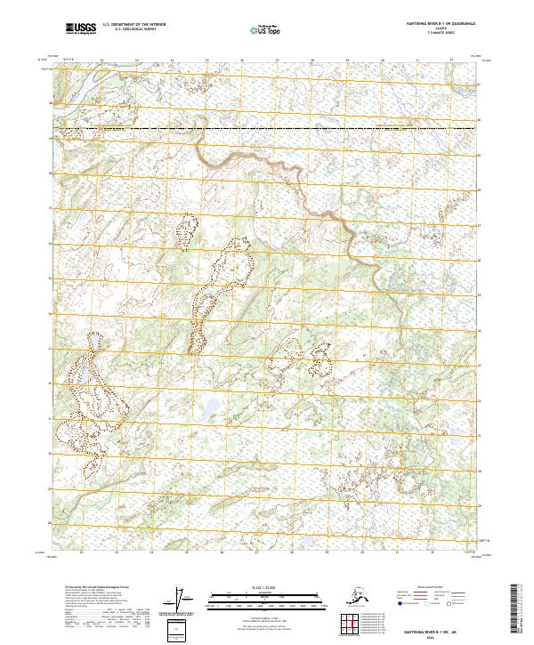
2024 Map of Kantishna River B-1 SW
USGS Topo · Published 2024About this map
The Kantishna River snakes through the northwestern corner of this interior Alaskan landscape, marking a watery boundary in a region defined by its complex drainage patterns. Braided channels and extensive wetlands dominate the terrain, where the Toklat River and the meandering Clear Creek provide the primary hydrologic structure. This 2024 edition shows the administrative intersection of the Denali Borough and the Yukon-Koyukuk Census Area, a division that cuts across the wilderness north of the Alaska Range. The map illustrates a landscape largely untouched by permanent road infrastructure, where seasonal water flow and vast marshlands dictate the character of the land. For researchers, the level of detail in the hydrography reveals the subtle elevation changes that define the different township and range sections, from t6s r15w through t8s r14w.
Find a feature on this map
10 named features on this map. Tap any name to fly to it.
Don’t see what you’re looking for? This feature index may not catch every label — zoom into the map to look around manually.
Map Details
Editions of this 2024 Kantishna River B-1 SW Map
This is the sole edition of this map. No revisions or reprints were ever made.
Other maps of this area

1948 · Kantishna River
USGS Topo · 1:250,000

1951 · Kantishna River
USGS Topo · 1:250,000

1952 · Kantishna River A-1
USGS Topo · 1:63,360

1952 · Kantishna River
USGS Topo · 1:250,000

1952 · Kantishna River A-2
USGS Topo · 1:63,360

1952 · Kantishna River B-1
USGS Topo · 1:63,360

1953 · Kantishna River B-2
USGS Topo · 1:63,360
1953 · Kantishna River A-1
USGS Topo · 1:63,360

1964 · Kantishna River
USGS Topo · 1:250,000
2017 · Kantishna River A-1 NW
USGS Topo · 1:25,000