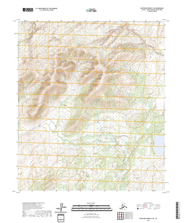
2024 Map of Kantishna River B-3 SE
USGS Topo · Published 2024About this map
John Hansen Creek winds through the southern portion of this Yukon-Koyukuk Census Area landscape, serving as the primary drainage for a region defined by substantial elevation changes and expansive wetlands. Surveyed in 2024, the map details the transition from the high, relief-heavy terrain in the northwestern and central sections to the water-saturated lowlands of the southeast. The area is largely delineated by its Public Land Survey System divisions, including t7s r18w and t6s r18w, which frame a territory devoid of permanent roads or major settlements. This environment reflects the untouched character of interior Alaska, where the natural course of the creek and the vast wetland patterns provide the only significant markers across the township and range lines.
Find a feature on this map
10 named features on this map. Tap any name to fly to it.
Don’t see what you’re looking for? This feature index may not catch every label — zoom into the map to look around manually.
Map Details
Editions of this 2024 Kantishna River B-3 SE Map
This is the sole edition of this map. No revisions or reprints were ever made.
Other maps of this area

1948 · Kantishna River
USGS Topo · 1:250,000

1951 · Kantishna River
USGS Topo · 1:250,000

1952 · Kantishna River A-3
USGS Topo · 1:63,360

1952 · Kantishna River
USGS Topo · 1:250,000

1952 · Kantishna River A-2
USGS Topo · 1:63,360

1953 · Kantishna River B-2
USGS Topo · 1:63,360

1953 · Kantishna River B-3
USGS Topo · 1:63,360

1953 · Kantishna River A-3
USGS Topo · 1:63,360

1964 · Kantishna River
USGS Topo · 1:250,000
2017 · Kantishna River B-3 SE
USGS Topo · 1:25,000