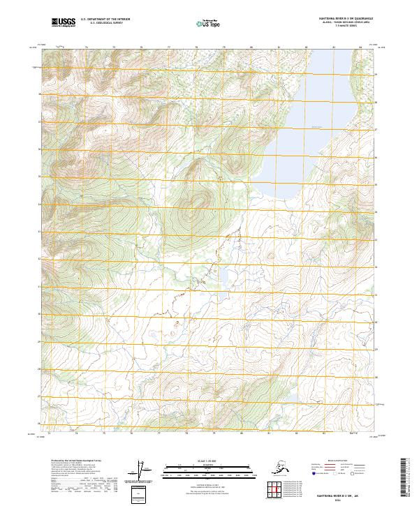
2024 Map of Kantishna River B-3 SW
USGS Topo · Published 2024About this map
Wien Lake dominates the northeastern landscape of this interior Alaska quadrangle within the Yukon-Koyukuk Census Area. The terrain is defined by the steady descent of the foothills toward the John Hansen Creek drainage, which winds through the southern reaches of the township boundaries. This 2024 representation, derived from data spanning decades including Spot satellite imagery from 2010, illustrates the intricate hydrography of the region before it joins the larger Kantishna River system. The map is primarily an environmental record, detailing the complex network of wetlands and the subtle elevation changes of the Tanana-Kuskokwim Lowlands.
Find a feature on this map
8 named features on this map. Tap any name to fly to it.
Don’t see what you’re looking for? This feature index may not catch every label — zoom into the map to look around manually.
Map Details
Editions of this 2024 Kantishna River B-3 SW Map
This is the sole edition of this map. No revisions or reprints were ever made.
Other maps of this area

1948 · Kantishna River
USGS Topo · 1:250,000

1951 · Kantishna River
USGS Topo · 1:250,000

1952 · Kantishna River A-3
USGS Topo · 1:63,360

1952 · Kantishna River
USGS Topo · 1:250,000

1953 · Kantishna River B-4
USGS Topo · 1:63,360

1953 · Kantishna River A-4
USGS Topo · 1:63,360

1953 · Kantishna River B-3
USGS Topo · 1:63,360

1953 · Kantishna River A-3
USGS Topo · 1:63,360

1964 · Kantishna River
USGS Topo · 1:250,000
2017 · Kantishna River B-3 SE
USGS Topo · 1:25,000