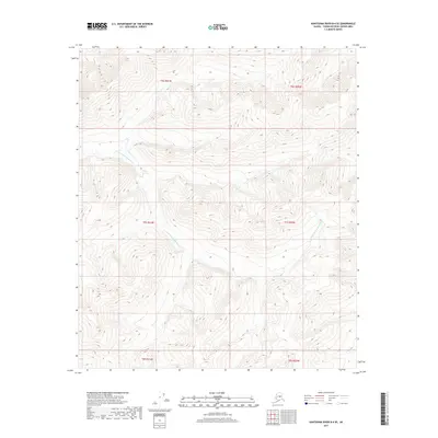
2017 Map of Kantishna River B-4 SE
USGS Topo · Published 2017About this map
The N Fork Kuskokwim River defines the drainage patterns of this Alaskan interior landscape, carving its way through the northwestern and central portions of the quadrangle. In the northeast, the Zitziana River flows toward its eventual confluence beyond the map borders. This 2017 survey reflects a largely undeveloped wilderness within the Alaska-Yukon-Koyukuk Census Area, characterized by high-elevation ridges and deep valleys. The absence of roads or permanent structures on this sheet underscores the isolation of the terrain between these two significant waterways, providing a clear picture of the natural topography as it remains in the early 21st century. The map serves as a vital record for understanding the hydrological divide between the Kuskokwim and Tanana river basins.
Find a feature on this map
8 named features on this map. Tap any name to fly to it.
Don’t see what you’re looking for? This feature index may not catch every label — zoom into the map to look around manually.
Map Details
Editions of this 2017 Kantishna River B-4 SE Map
This is the sole edition of this map. No revisions or reprints were ever made.
Other maps of this area

1948 · Kantishna River
USGS Topo · 1:250,000

1951 · Kantishna River
USGS Topo · 1:250,000

1952 · Kantishna River A-3
USGS Topo · 1:63,360

1952 · Kantishna River
USGS Topo · 1:250,000

1953 · Kantishna River B-4
USGS Topo · 1:63,360

1953 · Kantishna River A-4
USGS Topo · 1:63,360

1953 · Kantishna River B-3
USGS Topo · 1:63,360

1953 · Kantishna River A-3
USGS Topo · 1:63,360

1964 · Kantishna River
USGS Topo · 1:250,000
2017 · Kantishna River A-3 NW
USGS Topo · 1:25,000