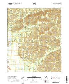
2017 Map of Kantishna River D-1 NE
USGS Topo · Published 2017About this map
Dugan Hills rise prominently across the northeastern corner of this interior Alaska landscape, forming the primary topographic relief in an area dominated by intricate drainage systems. The northern reaches are defined by the winding course of Dugan Cr, which meanders through the lowlands before flanking the hills. This 2017 survey details the complex terrain within the Yukon-Koyukuk Census Area, illustrating the stark elevation changes between the creek beds and the high ridges of the interior. The map focuses on the wilderness north of the Kantishna River system, providing a precise record of the natural landforms and watercourses within the township boundaries of t2n r13w, t2n r12w, t1n r13w, and t1n r12w.
Find a feature on this map
6 named features on this map. Tap any name to fly to it.
Don’t see what you’re looking for? This feature index may not catch every label — zoom into the map to look around manually.
Map Details
Editions of this 2017 Kantishna River D-1 NE Map
This is the sole edition of this map. No revisions or reprints were ever made.
Other maps of this area

1945 · Livengood
USGS Topo · 1:250,000

1948 · Kantishna River
USGS Topo · 1:250,000

1950 · Fairbanks
USGS Topo · 1:250,000

1951 · Kantishna River
USGS Topo · 1:250,000

1951 · Fairbanks
USGS Topo · 1:250,000

1951 · Tanana
USGS Topo · 1:250,000

1951 · Livengood
USGS Topo · 1:250,000

1952 · Tanana A-1
USGS Topo · 1:63,360

1952 · Livengood A-6
USGS Topo · 1:63,360

1952 · Kantishna River
USGS Topo · 1:250,000