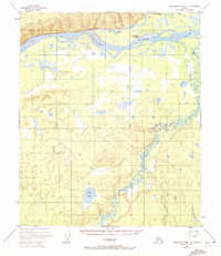
1952 Map of Kantishna River D-2
USGS Topo · Published 1972About this map
Manley Hot Springs serves as a focal point of activity along the Hot Springs Slough in this 1952 topographic survey. The settlement is supported by infrastructure including a Landing Strip, an Oil Tank, and the nearby Hot Springs Landing on the north bank of the Tanana River. This river corridor was a vital transportation artery for interior Alaska, further evidenced by the Sled Road winding eastward across the landscape.
Find a feature on this map
15 named features on this map. Tap any name to fly to it.
Don’t see what you’re looking for? This feature index may not catch every label — zoom into the map to look around manually.
Map Details
Editions of this 1952 Kantishna River D-2 Map
2 editions found
Other maps of this area

1948 · Kantishna River
USGS Topo · 1:250,000

1951 · Kantishna River
USGS Topo · 1:250,000

1951 · Tanana
USGS Topo · 1:250,000

1952 · Tanana A-1
USGS Topo · 1:63,360

1952 · Tanana A-3
USGS Topo · 1:63,360

1952 · Kantishna River C-1
USGS Topo · 1:63,360

1952 · Tanana A-2
USGS Topo · 1:63,360

1952 · Kantishna River
USGS Topo · 1:250,000

1952 · Kantishna River D-2
USGS Topo · 1:63,360

1952 · Kantishna River D-3
USGS Topo · 1:63,360