
1952 Map of Kantishna River C-1
USGS Topo · Published 1956About this map
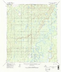
The Kantishna River carves a complex, meandering path through this interior Alaska landscape, defining the character of the terrain with its intricate oxbows and marshy lowlands. Surveyed in the early 1950s using aerial photography, the map reveals a remote environment where water dominates the geography, punctuated by hundreds of unnamed lakes and small ponds. A single Cabin located near a southern bend of the river serves as the only evidence of human habitation or structural development in the entire quadrangle, likely representing a seasonal trapping or hunting camp. This layout illustrates the minimal industrial and permanent settlement footprint in the Tanana Valley region during the mid-century era, highlighting the raw reliance on river systems for movement and survival in the bush.
Find a feature on this map
2 named features on this map. Tap any name to fly to it.
Don’t see what you’re looking for? This feature index may not catch every label — zoom into the map to look around manually.
Map Details
Editions of this 1952 Kantishna River C-1 Map
3 editions found
Other maps of this area

1948 · Kantishna River
USGS Topo · 1:250,000

1950 · Fairbanks
USGS Topo · 1:250,000

1951 · Kantishna River
USGS Topo · 1:250,000

1951 · Fairbanks
USGS Topo · 1:250,000

1952 · Kantishna River
USGS Topo · 1:250,000

1952 · Kantishna River B-1
USGS Topo · 1:63,360

1952 · Fairbanks
USGS Topo · 1:250,000

1952 · Kantishna River D-2
USGS Topo · 1:63,360
1952 · Fairbanks D-6
USGS Topo · 1:63,360
1953 · Fairbanks C-6
USGS Topo · 1:63,360