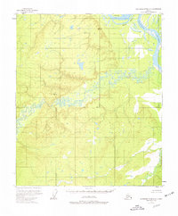
1953 Map of Kantishna River D-4
USGS Topo · Published 1977About this map
The Tanana River anchors this interior landscape as it winds through the northeast corner, featuring the prominent Harper Bend and Murray I. This 1950s survey, updated with minor revisions in 1965, illustrates a complex aqueous environment dominated by the meandering path of the Chitanana River. The terrain is marked by essential geodetic markers of the era, such as VABM 512 Harper and VABM 966 Nana, which served as critical points for aerial photogrammetric mapping. Further south, the Cosna River drains toward the larger river systems, while the surveyed Base Line cuts a straight path across the wilderness, providing the structural foundation for the township and range grid in this remote Alaskian interior.
Find a feature on this map
8 named features on this map. Tap any name to fly to it.
Don’t see what you’re looking for? This feature index may not catch every label — zoom into the map to look around manually.
Map Details
Editions of this 1953 Kantishna River D-4 Map
This is the sole edition of this map. No revisions or reprints were ever made.
Other maps of this area

1948 · Kantishna River
USGS Topo · 1:250,000

1951 · Kantishna River
USGS Topo · 1:250,000

1951 · Tanana
USGS Topo · 1:250,000

1952 · Tanana A-3
USGS Topo · 1:63,360

1952 · Tanana A-4
USGS Topo · 1:63,360

1952 · Kantishna River C-5
USGS Topo · 1:63,360

1952 · Kantishna River D-5
USGS Topo · 1:63,360

1952 · Kantishna River
USGS Topo · 1:250,000

1952 · Tanana A-5
USGS Topo · 1:63,360

1952 · Kantishna River D-3
USGS Topo · 1:63,360