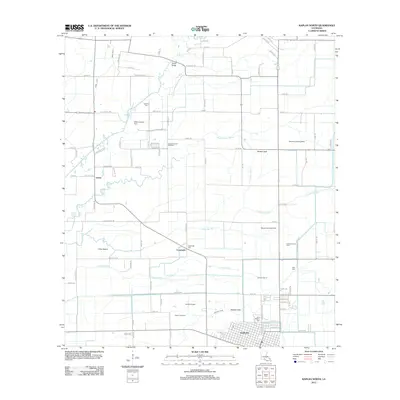
2012 Map of Kaplan North
USGS Topo · Published 2012About this map
Kaplan sits at the southern edge of this Vermilion Parish landscape, where the organized grid of the town gives way to a complex network of agricultural drainage and petroleum extraction. The region is defined by its water management, featuring a dense system of man-made waterways like Hunter Canal, Vincent Canal, and Sixth Ward Canal that interlace with natural features such as Bayou Queue De Tortue and Coulee Des Iles. This 2012 survey illustrates the modern economic drivers of the prairie, with the Kaplan Gas Field and Lelieux Oil and Gas Field appearing alongside several private airstrips, including Wills Landing Strip and Meaux Landing Strip. Local genealogy is well-represented through family-named landmarks and resting places, such as Abshire Cem, Mire Cem, and the community of Leleux, reflecting generations of settlement in the Acadiana region.
Find a feature on this map
100 named features on this map. Tap any name to fly to it.
Don’t see what you’re looking for? This feature index may not catch every label — zoom into the map to look around manually.
Map Details
Editions of this 2012 Kaplan North Map
This is the sole edition of this map. No revisions or reprints were ever made.
Other maps of this area

1932 · Abbeville NW
USGS Topo · 1:31,680

1934 · Duson
USGS Topo · 1:31,680

1946 · Morse
USGS Topo · 1:31,680

1946 · Leroy
USGS Topo · 1:31,680

1946 · Schooner Bayou NE
USGS Topo · 1:31,680

1946 · Schooner Bayou NW
USGS Topo · 1:31,680

1946 · Kaplan
USGS Topo · 1:31,680

1946 · Rayne
USGS Topo · 1:31,680

1949 · Estherwood
USGS Topo · 1:31,680

1952 · Lake Charles
USGS Topo · 1:250,000