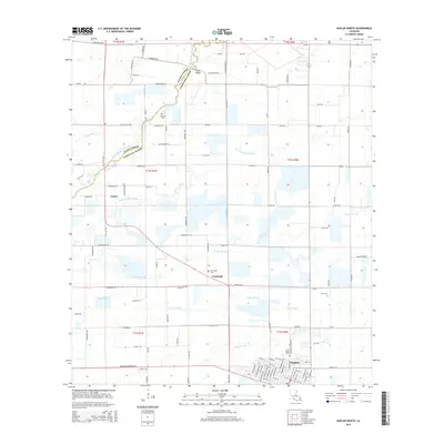
2015 Map of Kaplan North
USGS Topo · Published 2015About this map
Bayou Queue De Tortue marks the northern boundary of this landscape, winding through the borderlands between Acadia Parish and Vermilion Parish. This portion of southern Louisiana is defined by a dense network of drainage canals and natural gullies, including Hunter Canal, Castille Gully, and Coulee Des Iles, which weave through a grid of rural roads and agricultural plots. The town of Kaplan sits at the southern edge of the quadrangle, serving as a hub for the surrounding settlements of Leleux and Cossinade. For genealogists and local historians, the presence of several small burial sites like Abshire Cem, Mire Cem, and Cossinade Cem provides specific points for family research. The terrain transition from the winding bayou in the north to the strictly surveyed agricultural township lines in the south highlights the region's managed hydraulic environment.
Find a feature on this map
112 named features on this map. Tap any name to fly to it.
Don’t see what you’re looking for? This feature index may not catch every label — zoom into the map to look around manually.
Map Details
Editions of this 2015 Kaplan North Map
This is the sole edition of this map. No revisions or reprints were ever made.
Other maps of this area

1932 · Abbeville NW
USGS Topo · 1:31,680

1934 · Duson
USGS Topo · 1:31,680

1946 · Morse
USGS Topo · 1:31,680

1946 · Leroy
USGS Topo · 1:31,680

1946 · Schooner Bayou NE
USGS Topo · 1:31,680

1946 · Schooner Bayou NW
USGS Topo · 1:31,680

1946 · Kaplan
USGS Topo · 1:31,680

1946 · Rayne
USGS Topo · 1:31,680

1949 · Estherwood
USGS Topo · 1:31,680

1952 · Lake Charles
USGS Topo · 1:250,000