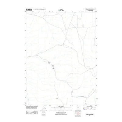
2012 Map of Kappes Canyon
USGS Topo · Published 2012About this map
Antelope Butte stands as a prominent landmark in this arid portion of Sweetwater County, where a network of seasonal watercourses and named canyons defines the high-desert topography. The drainage system is anchored by Sweetwater Cr and Cedar Cr, with the landscape carved into distinct passages like Kappes Canyon and Dugway Canyon. Though predominantly a natural landscape of ridges and washes, human activity is visible through isolated points of interest such as Mullen Camp Spring and Ninemile Spring, which likely served as vital water sources in this dry environment. The naming of Coal Mine Canyon suggests the region's industrial or geological history, while a sparse network of roads including Little Bitter Creek Rd and Radar Tower Rd provides access to these remote western Wyoming basins.
Find a feature on this map
18 named features on this map. Tap any name to fly to it.
Don’t see what you’re looking for? This feature index may not catch every label — zoom into the map to look around manually.
Map Details
Editions of this 2012 Kappes Canyon Map
This is the sole edition of this map. No revisions or reprints were ever made.
Other maps of this area

1908 · Rock Springs
USGS Topo · 1:62,500

1910 · Rock Springs
USGS Topo · 1:62,500

1954 · Rock Springs
USGS Topo · 1:250,000

1957 · Firehole Basin
USGS Topo · 1:62,500

1958 · Rock Springs
USGS Topo · 1:250,000

1961 · Kanda
USGS Topo · 1:24,000

1962 · Rock Springs
USGS Topo · 1:250,000

1966 · Firehole Basin
USGS Topo · 1:62,500
1968 · South Baxter
USGS Topo · 1:24,000
1968 · Earnest Butte
USGS Topo · 1:24,000