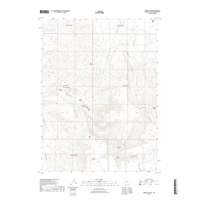
2017 Map of Kappes Canyon
USGS Topo · Published 2017About this map
Quaking Asp Mtn dominates the eastern horizon of this landscape, serving as a high-altitude anchor for a network of deeply incised drainages including Kappes Canyon and Rock Canyon. This 2017 survey reveals a terrain defined by its water sources and historical resource extraction, evidenced by features like Ninemile Spring and Coal Mine Canyon. The area is carved by numerous canyons, including Barney Canyon, Dugway Canyon, and Little Mellor Canyon, which channel seasonal flows toward larger basins. A sparse but critical road network, including Kappes Canyon Rd and Aspen Mountain Rd, provides access across the high plains and through the South Baxter Basin. To the south, Antelope Butte rises above Coyote Canyon, while Sand Wash and Little Bitter Cr suggest the arid hydrological character typical of Sweetwater County's high desert environment.
Find a feature on this map
31 named features on this map. Tap any name to fly to it.
Don’t see what you’re looking for? This feature index may not catch every label — zoom into the map to look around manually.
Map Details
Editions of this 2017 Kappes Canyon Map
This is the sole edition of this map. No revisions or reprints were ever made.
Other maps of this area

1908 · Rock Springs
USGS Topo · 1:62,500

1910 · Rock Springs
USGS Topo · 1:62,500

1954 · Rock Springs
USGS Topo · 1:250,000

1957 · Firehole Basin
USGS Topo · 1:62,500

1958 · Rock Springs
USGS Topo · 1:250,000

1961 · Kanda
USGS Topo · 1:24,000

1962 · Rock Springs
USGS Topo · 1:250,000

1966 · Firehole Basin
USGS Topo · 1:62,500
1968 · South Baxter
USGS Topo · 1:24,000
1968 · Earnest Butte
USGS Topo · 1:24,000