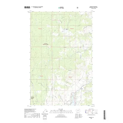
2020 Map of Karamin
USGS Topo · Published 2020About this map
Colville National Forest dominates the high country of northeastern Washington, providing a backdrop for the small settlement of Karamin. This modern topographic study reveals a landscape defined by sharp elevation changes between peaks like Franson Peak and the northern reaches of Curlew Lake. The network of forestry roads and rural lanes, such as Co Hwy 570 and Lundimo Mdws Rd, connect isolated water bodies like Mosquito Lake and Malo Lake to the scattered homesteads and ranches of the river valley.
Find a feature on this map
67 named features on this map. Tap any name to fly to it.
Don’t see what you’re looking for? This feature index may not catch every label — zoom into the map to look around manually.
Map Details
Editions of this 2020 Karamin Map
This is the sole edition of this map. No revisions or reprints were ever made.
Other maps of this area

1904 · Republic
USGS Topo · 1:125,000

1948 · Curlew
USGS Topo · 1:62,500

1948 · Republic
USGS Topo · 1:62,500

1951 · Wauconda
USGS Topo · 1:62,500

1951 · Curlew
USGS Topo · 1:62,500

1951 · Bodie Mountain
USGS Topo · 1:62,500

1951 · Republic
USGS Topo · 1:62,500

1954 · Okanogan
USGS Topo · 1:250,000

1958 · Okanogan
USGS Topo · 1:250,000

1958 · Aeneas
USGS Topo · 1:62,500