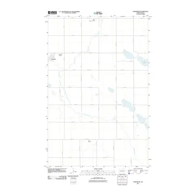
2011 Map of Karlsruhe
USGS Topo · Published 2011About this map
Karlsruhe anchors the northwestern corner of this McHenry County landscape, a region defined by the winding course of the Wintering River. The river snakes across the central and southern portions of the quadrangle, creating a series of wetlands and small basins that gather in the low-lying prairie. To the northeast, the terrain opens into several larger water bodies, most notably Herrington Lake. The map reveals a highly structured grid of section lines and gravel roads, such as 1st Ave N and 49th St N, which organize the vast agricultural acreage. For those tracing local heritage, several burial sites are documented including two distinct locations for the Saints Peter and Paul Cemetery near the town site and the more isolated Stenso Cemetery further south, providing clear evidence of early community nodes in this rural North Dakota interior.
Find a feature on this map
28 named features on this map. Tap any name to fly to it.
Don’t see what you’re looking for? This feature index may not catch every label — zoom into the map to look around manually.
Map Details
Editions of this 2011 Karlsruhe Map
This is the sole edition of this map. No revisions or reprints were ever made.
Other maps of this area

1929 · Balfour
USGS Topo · 1:62,500

1930 · Drake
USGS Topo · 1:62,500

1949 · Karlsruhe NW
USGS Topo · 1:24,000

1950 · Karlsruhe NE
USGS Topo · 1:24,000

1954 · Minot
USGS Topo · 1:250,000

1954 · McClusky
USGS Topo · 1:250,000

1955 · Rangeley NW
USGS Topo · 1:24,000

1957 · Bergen
USGS Topo · 1:24,000

1957 · Karlsruhe
USGS Topo · 1:24,000

1957 · Rangeley
USGS Topo · 1:24,000