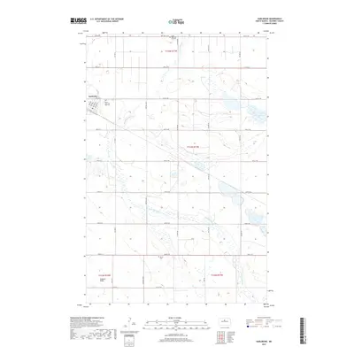
2017 Map of Karlsruhe
USGS Topo · Published 2017About this map
The small community of Karlsruhe anchors the northwestern corner of this McHenry County landscape, showing a tight grid of streets with names like Moscow St and Odessa St that reflect the heritage of the early settlers. Just north of the town site lies the Saints Peter and Paul Cem, a significant site for local family historians. The terrain is defined by the winding course of the Wintering River, which snakes across the prairie toward the southeast, eventually passing near Herrington Lake.
Find a feature on this map
36 named features on this map. Tap any name to fly to it.
Don’t see what you’re looking for? This feature index may not catch every label — zoom into the map to look around manually.
Map Details
Editions of this 2017 Karlsruhe Map
This is the sole edition of this map. No revisions or reprints were ever made.
Other maps of this area

1929 · Balfour
USGS Topo · 1:62,500

1930 · Drake
USGS Topo · 1:62,500

1949 · Karlsruhe NW
USGS Topo · 1:24,000

1950 · Karlsruhe NE
USGS Topo · 1:24,000

1954 · Minot
USGS Topo · 1:250,000

1954 · McClusky
USGS Topo · 1:250,000

1955 · Rangeley NW
USGS Topo · 1:24,000

1957 · Bergen
USGS Topo · 1:24,000

1957 · Karlsruhe
USGS Topo · 1:24,000

1957 · Rangeley
USGS Topo · 1:24,000