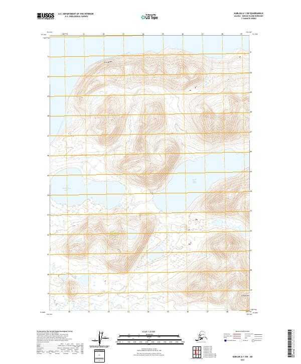
2021 Map of Karluk A-1 SW
USGS Topo · Published 2021About this map
South Olga Lakes and the surrounding coastal terrain dominate this section of Kodiak Island, illustrating the complex hydrology of the Alaskan shoreline. The landscape is defined by significant elevation changes, rising from the water's edge to the prominent heights of Luchek Mtn in the southeast and the steep coastal face of Stintz Bluffs to the north. Drainage patterns are centered on the Olga Cr system, which connects the lacustrine basins to the larger tidal environment. This 2021 survey serves as a precise record of the island's uninhabited interior, where the lack of road infrastructure underscores the area's isolation and reliance on natural waterways for navigation.
Find a feature on this map
10 named features on this map. Tap any name to fly to it.
Don’t see what you’re looking for? This feature index may not catch every label — zoom into the map to look around manually.
Map Details
Editions of this 2021 Karluk A-1 SW Map
This is the sole edition of this map. No revisions or reprints were ever made.
Other maps of this area

1951 · Trinity Islands
USGS Topo · 1:250,000

1951 · Karluk
USGS Topo · 1:250,000

1952 · Karluk
USGS Topo · 1:250,000

1952 · Trinity Islands D-2
USGS Topo · 1:63,360

1952 · Trinity Islands D-1
USGS Topo · 1:63,360

1952 · Karluk A-1
USGS Topo · 1:63,360

1952 · Karluk A-2
USGS Topo · 1:63,360
1954 · Karluk A-1
USGS Topo · 1:63,360
1954 · Trinity Islands D-1
USGS Topo · 1:63,360
1954 · Karluk A-2
USGS Topo · 1:63,360