
1952 Map of Karluk A-2
USGS Topo · Published 1975About this map
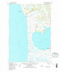
The Ayakulik River winds through the southwestern reaches of Kodiak Island, terminating at the small settlement of Ayakulik on the Pacific Ocean coast. This 1952 topographic study, later revised in 1973, details a landscape defined by its intersection with the Kodiak National Wildlife Refuge. The map reveals a remote network of survival and observation, featuring isolated cabins and the Fish and Wildlife Service Upper Station situated near Olga Cr. Coastal landmarks like Stormy Pt and Ayakulik Island provide navigational reference points along the treacherous shoreline. Inland, the terrain is marked by significant elevations including Mt Myrtle and Oval Mtn, alongside the distinct coastal rise of Ikpik Hill. The presence of the Olga Bay shoreline to the east illustrates the narrow land bridge that separates the island's interior waters from the open sea.
Find a feature on this map
24 named features on this map. Tap any name to fly to it.
Don’t see what you’re looking for? This feature index may not catch every label — zoom into the map to look around manually.
Map Details
Editions of this 1952 Karluk A-2 Map
3 editions found
Other maps of this area

1951 · Trinity Islands
USGS Topo · 1:250,000

1951 · Karluk
USGS Topo · 1:250,000

1952 · Karluk
USGS Topo · 1:250,000

1952 · Trinity Islands D-2
USGS Topo · 1:63,360

1952 · Karluk B-2
USGS Topo · 1:63,360

1952 · Karluk B-1
USGS Topo · 1:63,360

1952 · Trinity Islands D-1
USGS Topo · 1:63,360

1952 · Karluk A-1
USGS Topo · 1:63,360
1952 · Karluk B-3
USGS Topo · 1:63,360
1954 · Karluk A-1
USGS Topo · 1:63,360