
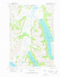
1952 Map of Karluk B-1
USGS Topo · Published 1966About this map
The waters of Karluk Lake and Frazer Lake dominate this interior portion of Kodiak Island as recorded in the early 1950s. This survey shows the remote wilderness entirely within the Kodiak National Wildlife Refuge, where transport and conservation activity centered on the Camp I Seaplane Base on the eastern shore of Karluk Lake. An administrative presence is marked by the U. S. Fish and Wildlife Service station, situated near several points like Island Pt and Tree Pt.
Find a feature on this map
33 named features on this map. Tap any name to fly to it.
Don’t see what you’re looking for? This feature index may not catch every label — zoom into the map to look around manually.
Map Details
Editions of this 1952 Karluk B-1 Map
2 editions found
Other maps of this area

1951 · Karluk
USGS Topo · 1:250,000

1952 · Kodiak
USGS Topo · 1:250,000

1952 · Karluk
USGS Topo · 1:250,000

1952 · Karluk C-2
USGS Topo · 1:63,360

1952 · Karluk B-2
USGS Topo · 1:63,360

1952 · Kodiak B-6
USGS Topo · 1:63,360

1952 · Karluk C-1
USGS Topo · 1:63,360

1952 · Kodiak C-6
USGS Topo · 1:63,360

1952 · Karluk A-1
USGS Topo · 1:63,360

1952 · Kodiak A-6
USGS Topo · 1:63,360