
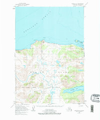
1952 Map of Karluk C-1
USGS Topo · Published 1967About this map
Kodiak National Wildlife Refuge dominates this section of western Kodiak Island, where the Karluk River winds through high terrain toward the Shelikof Strait. Surveyed in the early 1950s, the map documents a shoreline defined by landmarks like Rocky Pt and the wide expanse of Sevenmile Beach. Inland, the landscape is punctuated by numerous small lakes and the winding paths of a Tractor Trail that connects isolated structures.
Find a feature on this map
19 named features on this map. Tap any name to fly to it.
Don’t see what you’re looking for? This feature index may not catch every label — zoom into the map to look around manually.
Map Details
Editions of this 1952 Karluk C-1 Map
2 editions found
Other maps of this area

1951 · Karluk
USGS Topo · 1:250,000

1951 · Kodiak D-6
USGS Topo · 1:63,360

1952 · Kodiak
USGS Topo · 1:250,000

1952 · Karluk
USGS Topo · 1:250,000

1952 · Karluk C-2
USGS Topo · 1:63,360

1952 · Karluk B-2
USGS Topo · 1:63,360

1952 · Kodiak B-6
USGS Topo · 1:63,360

1952 · Karluk B-1
USGS Topo · 1:63,360

1952 · Kodiak C-6
USGS Topo · 1:63,360
1954 · Kodiak C-6
USGS Topo · 1:63,360