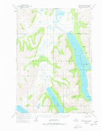
1952 Map of Karluk B-1
USGS Topo · Published 1978About this map
Karluk Lake dominates the central landscape of this interior Kodiak Island survey, serving as a critical nexus for the region's wilderness hydrology and early research infrastructure. As the entire land area is within the Kodiak National Wildlife Refuge, the map reveals a terrain defined by seasonal activity and biological study rather than permanent towns. Along the eastern shore of the lake, the U. S. Fish and Wildlife Service maintained a presence near the Camp I Seaplane Base, highlighting the importance of aerial access in this roadless environment. Numerous drainage systems including the Karluk River, Sturgeon River, and Moraine Creek flow through the valleys, while isolated Cabins and a Cabin near Stony Pt mark the few points of human habitation. The topographic detail captures a complex network of points and creeks, such as Grassy Pt and Halfway Creek, which provided essential landmarks for navigators and researchers in the mid-20th century.
Find a feature on this map
29 named features on this map. Tap any name to fly to it.
Don’t see what you’re looking for? This feature index may not catch every label — zoom into the map to look around manually.
Map Details
Editions of this 1952 Karluk B-1 Map
2 editions found
Other maps of this area

1951 · Karluk
USGS Topo · 1:250,000

1952 · Kodiak
USGS Topo · 1:250,000

1952 · Karluk
USGS Topo · 1:250,000

1952 · Karluk C-2
USGS Topo · 1:63,360

1952 · Karluk B-2
USGS Topo · 1:63,360

1952 · Kodiak B-6
USGS Topo · 1:63,360

1952 · Karluk B-1
USGS Topo · 1:63,360

1952 · Karluk C-1
USGS Topo · 1:63,360

1952 · Kodiak C-6
USGS Topo · 1:63,360

1952 · Karluk A-1
USGS Topo · 1:63,360