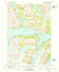
1954 Map of Karluk A-1
USGS Topo · Published 1955About this map
Kodiak Island and its remote coastal outposts are documented in this mid-1950s survey, highlighting the vital maritime and aviation infrastructure necessary for survival in the Kodiak National Wildlife Refuge. The map reveals a specialized economic landscape focused on the sea, with a Cannery and an adjacent Seaplane Airport situated near Akalura Creek. Numerous isolated Cabins dot the shores of Olga Bay and Moser Bay, reflecting a seasonal and subsistence-based presence in the territory before more modern development occurred.
Find a feature on this map
28 named features on this map. Tap any name to fly to it.
Don’t see what you’re looking for? This feature index may not catch every label — zoom into the map to look around manually.
Map Details
Editions of this 1954 Karluk A-1 Map
This is the sole edition of this map. No revisions or reprints were ever made.
Other maps of this area

1951 · Kaguyak
USGS Topo · 1:250,000

1951 · Trinity Islands
USGS Topo · 1:250,000

1951 · Karluk
USGS Topo · 1:250,000

1952 · Kodiak
USGS Topo · 1:250,000

1952 · Kaguyak
USGS Topo · 1:250,000

1952 · Karluk
USGS Topo · 1:250,000

1952 · Trinity Islands D-2
USGS Topo · 1:63,360

1952 · Karluk B-2
USGS Topo · 1:63,360

1952 · Kodiak B-6
USGS Topo · 1:63,360

1952 · Karluk B-1
USGS Topo · 1:63,360