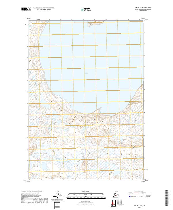
2021 Map of Karluk A-2 SE
USGS Topo · Published 2021About this map
Olga Bay dominates this coastal survey, where the saltwater reaches deep into the southwestern interior of Kodiak Island. The shoreline is defined by intricate tidal flats and marshlands that transition into a complex network of small ponds and wetlands further inland. At the northern entrance of the bay, the land narrows at Stormy Point, a prominent geographic feature overlooking the water. This 2021 update illustrates a landscape largely shaped by natural hydrography and public land boundaries rather than human settlement, preserving the character of the Alaska maritime wilderness. The map details the Township and Range lines, such as t36s r32w, which provide the essential framework for understanding property and territory in this remote island reach.
Find a feature on this map
8 named features on this map. Tap any name to fly to it.
Don’t see what you’re looking for? This feature index may not catch every label — zoom into the map to look around manually.
Map Details
Editions of this 2021 Karluk A-2 SE Map
This is the sole edition of this map. No revisions or reprints were ever made.
Other maps of this area

1951 · Trinity Islands
USGS Topo · 1:250,000

1951 · Karluk
USGS Topo · 1:250,000

1952 · Karluk
USGS Topo · 1:250,000

1952 · Trinity Islands D-2
USGS Topo · 1:63,360

1952 · Trinity Islands D-1
USGS Topo · 1:63,360

1952 · Karluk A-1
USGS Topo · 1:63,360

1952 · Karluk A-2
USGS Topo · 1:63,360
1954 · Karluk A-1
USGS Topo · 1:63,360
1954 · Trinity Islands D-1
USGS Topo · 1:63,360
1954 · Karluk A-2
USGS Topo · 1:63,360