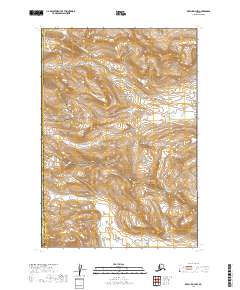
2019 Map of Karluk D-4 NW
USGS Topo · Published 2019About this map
Katmai National Park and the Becharof National Wildlife Refuge converge in this high-altitude landscape of the Alaska Peninsula, where the transition between the Kodiak Island Borough and the Lake and Peninsula Borough is defined by sharp topographic relief. The hydrological network is dominated by the headwaters of Big Kashvik Cr in the northern half of the sheet and North Cr to the south, both carving through steep terrain that remains largely untouched by modern infrastructure. This 2019 survey documents a wilderness environment where administrative boundaries follow the natural contours of the land, illustrating the vast protected acreage of the southwestern Alaskan coast before it meets the sea.
Find a feature on this map
12 named features on this map. Tap any name to fly to it.
Don’t see what you’re looking for? This feature index may not catch every label — zoom into the map to look around manually.
Map Details
Editions of this 2019 Karluk D-4 NW Map
This is the sole edition of this map. No revisions or reprints were ever made.
Other maps of this area

1948 · Mt Katmai
USGS Topo · 1:250,000

1951 · Mt Katmai
USGS Topo · 1:250,000

1951 · Karluk
USGS Topo · 1:250,000

1951 · Karluk D-4
USGS Topo · 1:63,360

1951 · Mount Katmai A-4
USGS Topo · 1:63,360

1951 · Karluk D-5
USGS Topo · 1:63,360

1951 · Mount Katmai A-5
USGS Topo · 1:63,360

1952 · Karluk
USGS Topo · 1:250,000

1964 · Mt. Katmai
USGS Topo · 1:250,000

1964 · Karluk
USGS Topo · 1:250,000