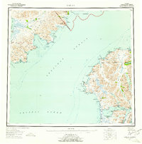
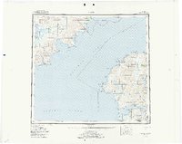
1952 Map of Karluk
USGS Topo · Published 1957About this map
The remote coastline of Kodiak Island and the Alaska Peninsula meet across the Shelikof Strait in this early 1950s survey. The indigenous and commercial fishing hub of Karluk sits at the mouth of the Karluk Lagoon, a critical point for the region's maritime activity. Across the strait on the mainland, the landscape is defined by the Katmai National Monument and the massive Becharof Lake, which feeds the Kejulik River. This map documents a period of strategic and ecological management, highlighting the Fish and Wildlife Service Upper Station and a Seaplane Base on the island's southern reach. The rugged shoreline is punctuated by numerous landmarks essential for navigation, such as Middle Cape and Tombstone Rocks, while interior features like Dog Salmon Flats suggest the seasonal rhythms of the local ecosystem.
Find a feature on this map
79 named features on this map. Tap any name to fly to it.
Don’t see what you’re looking for? This feature index may not catch every label — zoom into the map to look around manually.
Map Details
Editions of this 1952 Karluk Map
7 editions found

Other maps of this area

1943 · Ugashik
USGS Topo · 1:250,000

1948 · Mt Katmai
USGS Topo · 1:250,000

1948 · Ugashik
USGS Topo · 1:250,000

1949 · Ugashik
USGS Topo · 1:250,000

1951 · Kaguyak
USGS Topo · 1:250,000

1951 · Trinity Islands
USGS Topo · 1:250,000

1951 · Mt Katmai
USGS Topo · 1:250,000

1951 · Karluk
USGS Topo · 1:250,000

1951 · Sutwik Island
USGS Topo · 1:250,000

1951 · Mount Katmai A-3
USGS Topo · 1:63,360