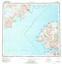
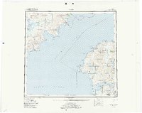
1952 Map of Karluk
USGS Topo · Published 1970About this map
The remote coastline of Kodiak Island and the mainland Alaska Peninsula meet across the Shelikof Strait in this mid-century survey. On the island side, the settlement of Karluk sits near the Karluk Anchorage, serving as a focal point for the region's maritime activity. The landscape is defined by the vast Kodiak National Wildlife Refuge, where the Sturgeon River and numerous lagoons carve through the terrain. Evidence of the area's essential infrastructure appears with the Seaplane Airport and the Fish and Wildlife Service Upper Station, reflecting the importance of federal conservation and aerial transport in this roadless wilderness.
Find a feature on this map
101 named features on this map. Tap any name to fly to it.
Don’t see what you’re looking for? This feature index may not catch every label — zoom into the map to look around manually.
Map Details
Editions of this 1952 Karluk Map
7 editions found

Other maps of this area

1943 · Ugashik
USGS Topo · 1:250,000

1948 · Mt Katmai
USGS Topo · 1:250,000

1948 · Ugashik
USGS Topo · 1:250,000

1949 · Ugashik
USGS Topo · 1:250,000

1951 · Kaguyak
USGS Topo · 1:250,000

1951 · Trinity Islands
USGS Topo · 1:250,000

1951 · Mt Katmai
USGS Topo · 1:250,000

1951 · Karluk
USGS Topo · 1:250,000

1951 · Sutwik Island
USGS Topo · 1:250,000

1951 · Mount Katmai A-3
USGS Topo · 1:63,360