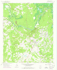
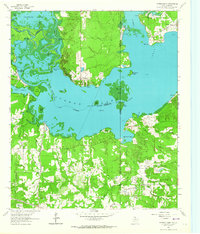
1962 Map of Karnack
USGS Topo · Published 1978About this map
Longhorn Ordnance Works dominates the eastern portion of this landscape, its industrial grid and railway spurs contrasting sharply with the labyrinthine wetlands of the Big Cypress Bayou and Caddo Lake. The settlement of Karnack serves as a hub between the massive munitions plant and the waters of Caddo Lake State Park. Along the bayou, a complex network of chutes and sloughs including Clintons Chute and Whistleberry Slough illustrates the dynamic, flood-prone nature of the East Texas bottomlands. This 1962 record, with revisions through the 1970s, captures the intersection of heavy industry and preservation. Rural life is evidenced by family-named landmarks like Littletons Lake and Taylors Lake, alongside local gathering places such as Peters Chapel and Carver High Sch. The map also traces the infrastructure of the era, from the Louisiana and Arkansas rail lines to the Beers Caddo Lake Airport.
Find a feature on this map
63 named features on this map. Tap any name to fly to it.
Don’t see what you’re looking for? This feature index may not catch every label — zoom into the map to look around manually.
Map Details
Editions of this 1962 Karnack Map
2 editions found
Other maps of this area

1944 · Kildare
USGS Topo · 1:62,500

1944 · Caddo Lake
USGS Topo · 1:62,500

1946 · Caddo Lake
USGS Topo · 1:62,500

1948 · Kildare
USGS Topo · 1:62,500

1956 · Tyler
USGS Topo · 1:250,000
1962 · Trees
USGS Topo · 1:24,000

1962 · Woodlawn
USGS Topo · 1:24,000
1962 · Smithland
USGS Topo · 1:24,000

1962 · Jefferson
USGS Topo · 1:24,000
1962 · Potters Point
USGS Topo · 1:24,000