
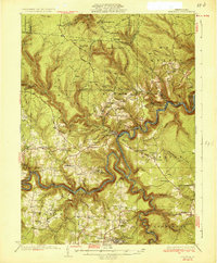
1932 Map of Karthaus
USGS Topo · Published 1932About this map
The West Branch Susquehanna River snakes through deep plateau cuts in this 1929 survey, serving as the central artery for a landscape defined by timber, early trails, and isolated settlements. Along the river, the New York Central RR follows the northern bank, passing through Karthaus and past the Coleman Siding. High above the river bends, the Three Runs Fire Tower and Arnold Mtn overlook a network of backcountry paths including the Mahoning Trail and Gentz Trail. The map captures a high density of rural infrastructure from this era, specifically visible in the numerous neighborhood schools like Buck Run Sch, German Settlement Sch, and Sylvan Grove Sch. Settlements such as Frenchville and Keewaydin anchor the upland plateaus, where Fairview Ch and Palestine Ch served the local farming and coal-mining communities.
Find a feature on this map
90 named features on this map. Tap any name to fly to it.
Don’t see what you’re looking for? This feature index may not catch every label — zoom into the map to look around manually.
Map Details
Editions of this 1932 Karthaus Map
3 editions found
Other maps of this area

1903 · Houtzdale
USGS Topo · 1:62,500

1905 · Houtzdale
USGS Topo · 1:62,500

1908 · Bellefonte
USGS Topo · 1:62,500

1909 · Bellefonte
USGS Topo · 1:62,500

1922 · Philipsburg
USGS Topo · 1:62,500

1928 · Snow Shoe
USGS Topo · 1:48,000

1929 · Karthaus
USGS Topo · 1:62,500

1929 · Clearfield
USGS Topo · 1:48,000

1931 · Show Shoe
USGS Topo · 1:62,500

1932 · Clearfield
USGS Topo · 1:62,500
Featured Places
- Karthaus Township, PA
- Moshannon, PA
- Benezette Township, PA
- Rush Township, PA
- Rolling Stone, Covington Township