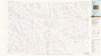
1984 Map of Karval
USGS Topo · Published 1984About this map
Karval sits as a central hub in this high-plains landscape of eastern Colorado, where the transition from ranching to conservation is marked by the Karval State Wildlife Area. This 1984 survey documents a region defined by its hydrologic drainage, with complex seasonal systems like South Rush Creek, Middle Rush Creek, and North Rush Creek converging across the Lincoln County terrain. The northern corridor is anchored by the Union Pacific railroad, which ties together small rail-stops and settlements like Boyero, Aroya, and Wild Horse.
Find a feature on this map
67 named features on this map. Tap any name to fly to it.
Don’t see what you’re looking for? This feature index may not catch every label — zoom into the map to look around manually.
Map Details
Editions of this 1984 Karval Map
This is the sole edition of this map. No revisions or reprints were ever made.
Other maps of this area

1889 · Sanborn
USGS Topo · 1:125,000

1891 · Sanborn
USGS Topo · 1:125,000

1891 · Catlin
USGS Topo · 1:125,000

1891 · Arroyo
USGS Topo · 1:125,000

1891 · Kit Carson
USGS Topo · 1:125,000

1891 · Las Animas
USGS Topo · 1:125,000

1891 · Nepesta
USGS Topo · 1:125,000

1891 · Limon
USGS Topo · 1:125,000

1892 · Lamar
USGS Topo · 1:125,000

1892 · Limon
USGS Topo · 1:125,000