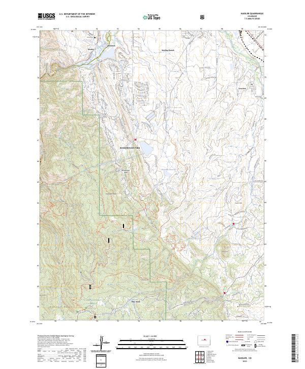
2023 Map of Kassler
USGS Topo · Published 2023About this map
The South Platte River and the High Line Canal dominate the northern landscape of this Douglas County region, where the foothills of the Rampart Range meet the plains. Near the settlement of Kassler, the Waterton Canyon Trl follows the river's path through the deep Platte Canyon, a historic corridor for water management and transit. To the east, the planned development of Sterling Ranch and the residential layout of Roxborough Park contrast with the rugged topography of the Pike National Forest. Evidence of significant infrastructure is visible in the Aurora Rampart Tunnel Number 2, which cuts through the mountainside below Carpenter Peak. Further south, the map identifies the Brotherhood of the White Temple School and the small community of Pine Nook near Jarre Creek, illustrating the area's mix of modern suburban growth and isolated cultural sites.
Find a feature on this map
118 named features on this map. Tap any name to fly to it.
Don’t see what you’re looking for? This feature index may not catch every label — zoom into the map to look around manually.
Map Details
Editions of this 2023 Kassler Map
This is the sole edition of this map. No revisions or reprints were ever made.
Other maps of this area

1890 · East Denver
USGS Topo · 1:125,000

1893 · Platte Canyon
USGS Topo · 1:125,000

1894 · Castle Rock
USGS Topo · 1:125,000

1899 · West Denver
USGS Topo · 1:125,000

1913 · Castle Rock
USGS Topo · 1:125,000

1935 · East Denver Nos. 3 and 4
USGS Topo · 1:48,000

1940 · Castle Rock
USGS Topo · 1:62,500

1942 · Highland Ranch
USGS Topo · 1:31,680

1942 · Littleton
USGS Topo · 1:31,680

1945 · Castle Rock
USGS Topo · 1:62,500