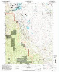
1994 Map of Kassler
USGS Topo · Published 1998About this map
Waterton and Kassler sit at the mouth of the Platte Canyon, serving as critical points for Denver's regional water infrastructure in the mid-1990s. The landscape is defined by the dramatic north-south ridge of the Hogback, which separates the high plains from the foothills of the Front Range. This geological boundary is preserved within Roxborough State Park, where the red rock formations transition into the timbered slopes of the Pike National Forest.
Find a feature on this map
36 named features on this map. Tap any name to fly to it.
Don’t see what you’re looking for? This feature index may not catch every label — zoom into the map to look around manually.
Map Details
Editions of this 1994 Kassler Map
This is the sole edition of this map. No revisions or reprints were ever made.
Other maps of this area

1890 · East Denver
USGS Topo · 1:125,000

1893 · Platte Canyon
USGS Topo · 1:125,000

1894 · Castle Rock
USGS Topo · 1:125,000

1899 · West Denver
USGS Topo · 1:125,000

1913 · Castle Rock
USGS Topo · 1:125,000

1935 · East Denver Nos. 3 and 4
USGS Topo · 1:48,000

1940 · Castle Rock
USGS Topo · 1:62,500

1942 · Highland Ranch
USGS Topo · 1:31,680

1942 · Littleton
USGS Topo · 1:31,680

1945 · Castle Rock
USGS Topo · 1:62,500