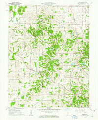
1961 Map of Kasson
USGS Topo · Published 1970About this map
Saint Wendel and Parkers Settlement anchor this 1961 survey of the borderlands between Posey and Vanderburgh counties. The landscape is defined by a dense network of country roads such as Spahl Road and Diamond Road, connecting small agrarian hubs and family-named cemeteries. For genealogists, the map is particularly detailed, identifying local landmarks like Engleheim Cem, Kunze Cem, and St Peters Ch.
Find a feature on this map
41 named features on this map. Tap any name to fly to it.
Don’t see what you’re looking for? This feature index may not catch every label — zoom into the map to look around manually.
Map Details
Editions of this 1961 Kasson Map
2 editions found
Other maps of this area

1901 · Haubstadt
USGS Topo · 1:62,500

1903 · Haubstadt
USGS Topo · 1:62,500

1903 · New Harmony
USGS Topo · 1:62,500

1903 · Patoka
USGS Topo · 1:125,000

1914 · Henderson
USGS Topo · 1:48,000

1916 · Henderson
USGS Topo · 1:62,500

1917 · Uniontown
USGS Topo · 1:62,500

1938 · New Harmony
USGS Topo · 1:62,500

1952 · Evansville
USGS Topo · 1:24,000

1954 · Evansville
USGS Topo · 1:250,000