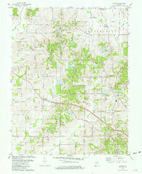
1981 Map of Kasson
USGS Topo · Published 1981About this map
Posey and Vanderburgh County lines divide this rural landscape during the early 1980s, where traditional agriculture meets a persistent Oil Field presence. Scattered across the rolling terrain are established Catholic and Lutheran communities, anchored by the St Peters Ch and Zion Ch. The mapping reveals a transition in rural education and land use, showing several local schools like No 3 School alongside a network of family-named cemeteries such as Engleheim Cem and Higinbottom Cem. The Illinois Central Gulf railroad cuts through the northern townships of Armstrong and Center, connecting small hubs like St Wendel and Martin to the broader regional economy. From the southern boundary at Five Dollar Road to the northern Base Line Road, the map documents a stable midwestern landscape of small settlements and creek-fed valleys.
Find a feature on this map
52 named features on this map. Tap any name to fly to it.
Don’t see what you’re looking for? This feature index may not catch every label — zoom into the map to look around manually.
Map Details
Editions of this 1981 Kasson Map
Other maps of this area

1901 · Haubstadt
USGS Topo · 1:62,500

1903 · Haubstadt
USGS Topo · 1:62,500

1903 · New Harmony
USGS Topo · 1:62,500

1903 · Patoka
USGS Topo · 1:125,000

1914 · Henderson
USGS Topo · 1:48,000

1916 · Henderson
USGS Topo · 1:62,500

1917 · Uniontown
USGS Topo · 1:62,500

1938 · New Harmony
USGS Topo · 1:62,500

1952 · Evansville
USGS Topo · 1:24,000

1954 · Evansville
USGS Topo · 1:250,000