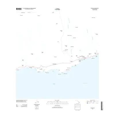
2013 Map of Kaupo
USGS Topo · Published 2013About this map
Hale o Kane Heiau and Loaloa Heiau stand as significant cultural landmarks along the southern coast of Maui, anchoring a landscape where steep volcanic ridges meet the Pacific. This 2013 survey of the Kaupō region illustrates a sparsely populated but historically rich area, where the road roughly follows the shoreline through settlements like Pukaauhuhu and Mokulau. The terrain is defined by dramatic elevation changes, from the deep Kaupō Gap and the heights of Haleakalā down through numerous gulches such as Manawainui Valley and Kālepa Gulch. Maritime history is evident at Nu'u Landing and Mokulau Landing, while the interior remains largely undeveloped, marked only by remote outposts like the Kapalaoa Cabin near Haleakalā Crater. The map captures a unique coastal environment where traditional sites and natural features like Nu'u Salt Pond remain prominent.
Find a feature on this map
68 named features on this map. Tap any name to fly to it.
Don’t see what you’re looking for? This feature index may not catch every label — zoom into the map to look around manually.
Map Details
Editions of this 2013 Kaupo Map
This is the sole edition of this map. No revisions or reprints were ever made.
Other maps of this area

1954 · Maui
USGS Topo · 1:250,000

1957 · Kilohana
USGS Topo · 1:24,000

1957 · Kipahulu
USGS Topo · 1:24,000

1957 · Hana
USGS Topo · 1:24,000

1957 · Lualailua Hills
USGS Topo · 1:24,000

1957 · Nahiku
USGS Topo · 1:24,000

1957 · Kaupo
USGS Topo · 1:24,000

1966 · Maui
USGS Topo · 1:250,000

1974 · Maui
USGS Topo · 1:250,000

1978 · Hana
USGS Topo · 1:24,000