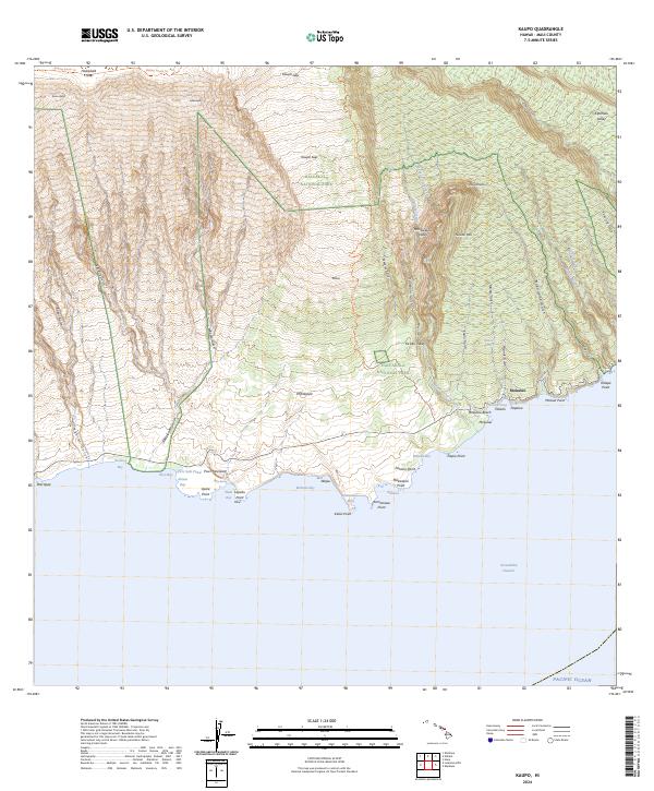
2024 Map of Kaupo
USGS Topo · Published 2024About this map
The dramatic southern flank of Maui descends from the heights of Haleakalā Crater to the Pacific coast in this detailed topographic study. The landscape is defined by the massive breach of the Kaupo Gap, where the Haleakalā Wilderness and Haleakalā National Park protect the volcanic terrain. Historic transit routes like the Sliding Sands Trl and Kaupo Trl provide passage through the steep elevation changes, connecting the high crater floor with the coastal settlements below.
Find a feature on this map
65 named features on this map. Tap any name to fly to it.
Don’t see what you’re looking for? This feature index may not catch every label — zoom into the map to look around manually.
Map Details
Editions of this 2024 Kaupo Map
This is the sole edition of this map. No revisions or reprints were ever made.
Other maps of this area

1954 · Maui
USGS Topo · 1:250,000

1957 · Kilohana
USGS Topo · 1:24,000

1957 · Kipahulu
USGS Topo · 1:24,000

1957 · Hana
USGS Topo · 1:24,000

1957 · Lualailua Hills
USGS Topo · 1:24,000

1957 · Nahiku
USGS Topo · 1:24,000

1957 · Kaupo
USGS Topo · 1:24,000

1966 · Maui
USGS Topo · 1:250,000

1974 · Maui
USGS Topo · 1:250,000

1978 · Hana
USGS Topo · 1:24,000