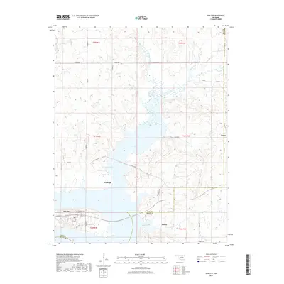
2018 Map of Kaw City
USGS Topo · Published 2018About this map
Kaw Lake dominates the central landscape of this Oklahoma terrain, shaping the modern geography of the area north of Kaw City. The settlement of Washunga is positioned along the western banks of Washunga Bay, where the historic Washunga Cem remains a significant local landmark. This 2018 survey illustrates the complex relationship between the reservoir and the surrounding prairie, with numerous tributaries such as Little Beaver Creek and Rabbit Creek feeding into the basin. The eastern edge of the map follows the Kay Co Osage Co line, where the landscape transitions into more dissected upland terrain. Small communities and named locales like Cooper, Soldani, and Apperson are scattered across the rural road network, which includes routes like E Kildare Rd and Sarge Creek RD. Near the southwestern corner, Grandview Cem sits on the outskirts of the relocated Kaw City site, overlooking the waters that redefined this region.
Find a feature on this map
53 named features on this map. Tap any name to fly to it.
Don’t see what you’re looking for? This feature index may not catch every label — zoom into the map to look around manually.
Map Details
Editions of this 2018 Kaw City Map
This is the sole edition of this map. No revisions or reprints were ever made.
Other maps of this area

1916 · Foraker
USGS Topo · 1:62,500

1932 · Fairfax
USGS Topo · 1:62,500

1935 · Kaw
USGS Topo · 1:62,500

1936 · Belford
USGS Topo · 1:62,500

1955 · Enid
USGS Topo · 1:250,000

1958 · Enid
USGS Topo · 1:250,000

1963 · Charley Creek
USGS Topo · 1:24,000

1963 · Uncas
USGS Topo · 1:24,000

1963 · Kaw City NW
USGS Topo · 1:24,000

1964 · Charley Creek NE
USGS Topo · 1:24,000